
ߞߐߕߐ߮:Mali adm location map.svg

ߞߐߕߐ߮ ߓߊߛߎ߲ (SVG ߞߐߕߐ߮, ߕߐ߯ߦߊߟߌ ߁,߆߄߄ × ߁,߅߆߈ ߖߌ߬ߦߊ߬ߘߊ߲ߕߊ, ߞߐߕߐ߮ ߢߊ߲ߞߊ߲: ߃߀߁ KB)
ߟߊߘߛߏߣߍ߲
| ߕߐ߯ߟߊߘߏ߲ |
Deutsch: Positionskarte von Mali
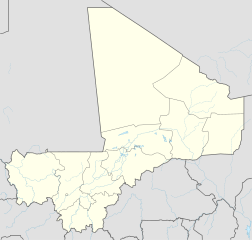
English: Location map of Mali
|
||||||||||||
| ߕߎ߬ߡߊ߬ߘߊ | |||||||||||||
| ߛߎ߲ |
Own work using:
|
||||||||||||
| ߛߓߍߦߟߊ | NordNordWest | ||||||||||||
| Other versions |
|
||||||||||||
_location_map.svg)

|
This map has been made or improved in the German Kartenwerkstatt (Map Lab). You can propose maps to improve as well.
|
ߟߊ߬ߘߌ߬ߢߍ߬ߟߌ ߦߴߌ ߘߐ߫
Usage of this file with:

explanatory notes: Legally binding is only the full legalcode. For a free usage I recommend to respect the following licence conditions:
1. Provide my name as given above: NordNordWest,
2. a copy of, or the URI for, the applicable license: https://creativecommons.org/licenses/by-sa/3.0/de/legalcode,
3. the title of the work,
4. in the case of an adaptation, a credit identifying the use of the work in the adaptation.
This license and the rights granted hereunder will terminate automatically upon any breach by you of the terms of this license. Any of the above conditions can be waived if you get permission from the copyright holder. If you have questions or wish differing conditions, please contact me through nnwest or my discussion page ![]() t-online.de
t-online.de
- ߌ ߞߊ߲ߠߊߓߌ߬ߟߊ߬ߣߍ߲߫
- ߞߵߊ߬ ߟߊߖߍ߲ߛߍ߲߫ – ߞߊ߬ ߓߊ߯ߙߊ ߓߊߞߎߘߦߊ߫߸ ߞߴߊ߬ ߘߐߝߘߊ߫߸ ߊ߬ ߣߌ߫ ߞߵߊ߬ ߟߊߕߊ߬ߡߌ߲߬
- ߞߵߊ߬ ߢߣߊߓߊ߬ߛߊ߲߬ ߕߎ߲߯ – ߞߊ߬ ߓߊ߯ߙߊ ߟߊߘߏ߲߬
- ߓߍ߲߬ߒߡߊ߬ߞߊ߲߫ ߣߊ߬ߕߐ ߢߌ߲߬ ߠߎ߬ ߟߊ߫:
- ߘߎ߲߬ߘߎ߬ߡߊ߬ߦߊ – ߌ ߦߋ߫ ߞߍߕߊ ߓߍ߲߬ߣߍ߲ ߠߊߘߏ߲߬߸ ߞߊ߬ ߟߊ߬ߘߌ߬ߢߍ߬ߟߌ ߛߘߌ߬ߜߋ߲ ߘߏ߫ ߡߊߛߐ߫߸ ߊ߬ ߣߌ߫ ߞߊ߬ ߞߐ߯ߙߍߦߊ߫ ߣߌ߫ ߡߊ߬ߦߟߍ߬ߡߊ߲߬ߠߌ߲ ߞߍߣߍ߲߫ ߞߍ߫ ߘߊ߫. ߌ ߦߴߏ߬ ߞߍ߫ ߞߍߢߊ߫ ߟߊߘߌ߬ߢߍ߬ߣߍ߲ ߓߍ߯ ߡߊ߬߸ ߞߏ߬ߣߌ߲߬ ߢߊ ߓߍ߯ ߡߊ߬ ߞߏ߫ ߕߍ߫ ߘߋ߬߸ ߡߍ߲ ߘߌ߫ ߛߋ߫ ߟߊ߬ߘߌ߬ߢߍ߬ߟߊ ߘߐߛߎ߫ ߟߴߌ ߞߊ߲ߛߏ߲߫ ߡߊ߬߸ ߥߟߊ߫ ߌ ߟߊ߫ ߟߊ߬ߓߊ߰ߙߊߟߊ.
- ߘߍ߬ߒ߬ߡߊ߬ ߝߋ߲ – ߣߴߌ ߞߵߊ߬ ߡߊߦߟߍ߬ߡߊ߲߫߸ ߖߙߎߡߎ߲ ߦߟߍ߬ߡߊ߲߫߸ ߥߟߊ߫ ߞߵߊ߬ ߓߊ߯ߙߊ ߓߐ߬ߓߐ ߣߌ߲߬ ߞߊ߲߬߸ ߌ ߞߍߕߐ߫ ߦߋ߫ ߞߐߖߋߓߌ߫ ߞߋߟߋ߲߫ ߠߋ߬ ߘߐߝߘߊ߫ ߟߊ߫ ߥߟߊ߫ ߌ ߟߊ߫ ߡߊ߬ߜߍ߲ ߞߍ߫ ߕߐ߫ ߦߋ߫

ߞߐߕߐ߮ ߟߊ߫ ߘߐ߬ߝߐ
ߕߎ߬ߡߊ߬ߘߊ/ߕߎ߬ߡߊ ߛߐ߲߬ߞߌ߲߬ ߓߊ߫߸ ߞߊ߬ ߕߎ߬ߡߊ߬ߘߊ ߞߐߕߐ߮ ߟߎ߬ ߦߋ߫.
| ߕߎ߬ߡߊ߬ߘߊ/ߕߎ߬ߡߊ߬ߟߊ߲ | ߞߝߊ߬ߟߋ߲ߛߋ߲ | ߛߎߡߊ߲ߘߐ | ߟߊ߬ߓߊ߰ߙߊ߬ߟߊ | ߞߊ߲߬ߝߐߟߌ | |
|---|---|---|---|---|---|
| ߞߍߛߊ߲ߞߏ | ߂߀:߂߅, ߁߈ ߘߓߊ߬ߕߊ ߂߀߁߉ | | ߁,߆߄߄ × ߁,߅߆߈ (߃߀߁ KB) | NordNordWest | upd |
| ߁߃:߄߃, ߃߀ ߣߍߣߍߓߊ ߂߀߁߄ |  | ߁,߆߄߄ × ߁,߅߆߈ (߂߉߇ KB) | NordNordWest | == {{int:filedesc}} == {{Information |Description= {{de|1=Positionskarte von Mali}} {{en|1=Location map of Mali}} {{Location map series N |stretching=105 |top=25.5 |bottom=9.7 |left=-12.6 |right=4.8 }} |Source={{Own using}} * United States National Ima... |
ߞߐߕߐ߮ ߟߊߓߊ߯ߙߊߟߌ
ߞߐߕߐ߮ ߟߊߓߊ߯ߙߊߟߌ߫ ߞߙߎߞߙߍ
ߥߞߌ߫ ߕߐ߭ ߢߌ߲߬ ߠߎ߬ ߦߋ߫ ߞߐߕߐ߮ ߣߌ߲߬ ߠߊߓߊ߯ߙߊ߫ ߟߊ߫:
- ߊ߬ ߟߊߓߊ߯ߙߊ߫ af.wikipedia.org ߘߐ߫
- ߊ߬ ߟߊߓߊ߯ߙߊ߫ am.wikipedia.org ߘߐ߫
- ߊ߬ ߟߊߓߊ߯ߙߊ߫ an.wikipedia.org ߘߐ߫
- ߊ߬ ߟߊߓߊ߯ߙߊ߫ ar.wikipedia.org ߘߐ߫
- ߊ߬ ߟߊߓߊ߯ߙߊ߫ arz.wikipedia.org ߘߐ߫
- ߊ߬ ߟߊߓߊ߯ߙߊ߫ ast.wikipedia.org ߘߐ߫
- ߊ߬ ߟߊߓߊ߯ߙߊ߫ azb.wikipedia.org ߘߐ߫
- ߊ߬ ߟߊߓߊ߯ߙߊ߫ az.wikipedia.org ߘߐ߫
- ߊ߬ ߟߊߓߊ߯ߙߊ߫ ba.wikipedia.org ߘߐ߫
- ߊ߬ ߟߊߓߊ߯ߙߊ߫ be-tarask.wikipedia.org ߘߐ߫
- ߊ߬ ߟߊߓߊ߯ߙߊ߫ be.wikipedia.org ߘߐ߫
ߞߐߕߐ߮ ߣߌ߲߬ more global usage ߦߋߟߌ.